blah blah blah
The Basin Rim
Length: 4.5 miles out-and-backDifficulty (click for info): Easy
Elevation Gain: 820 feet
Rating (click for info): 7/10
Elevation: 1960'
Driving Directions:
Trailhead and parking area are on Wild River Road in Bean's Purchase, NH. Wild River Road leaves the west side of Maine Rt. 113, 3.2 miles south of Rt. 2 in Gilead, ME and 12.3 miles north of Rt. 113B. Travel 5.7 miles down Wild River Road, crossing back into NH, and turn left into a parking area for the Wild River Campground. Click here for a Google Map.
About the Hike:
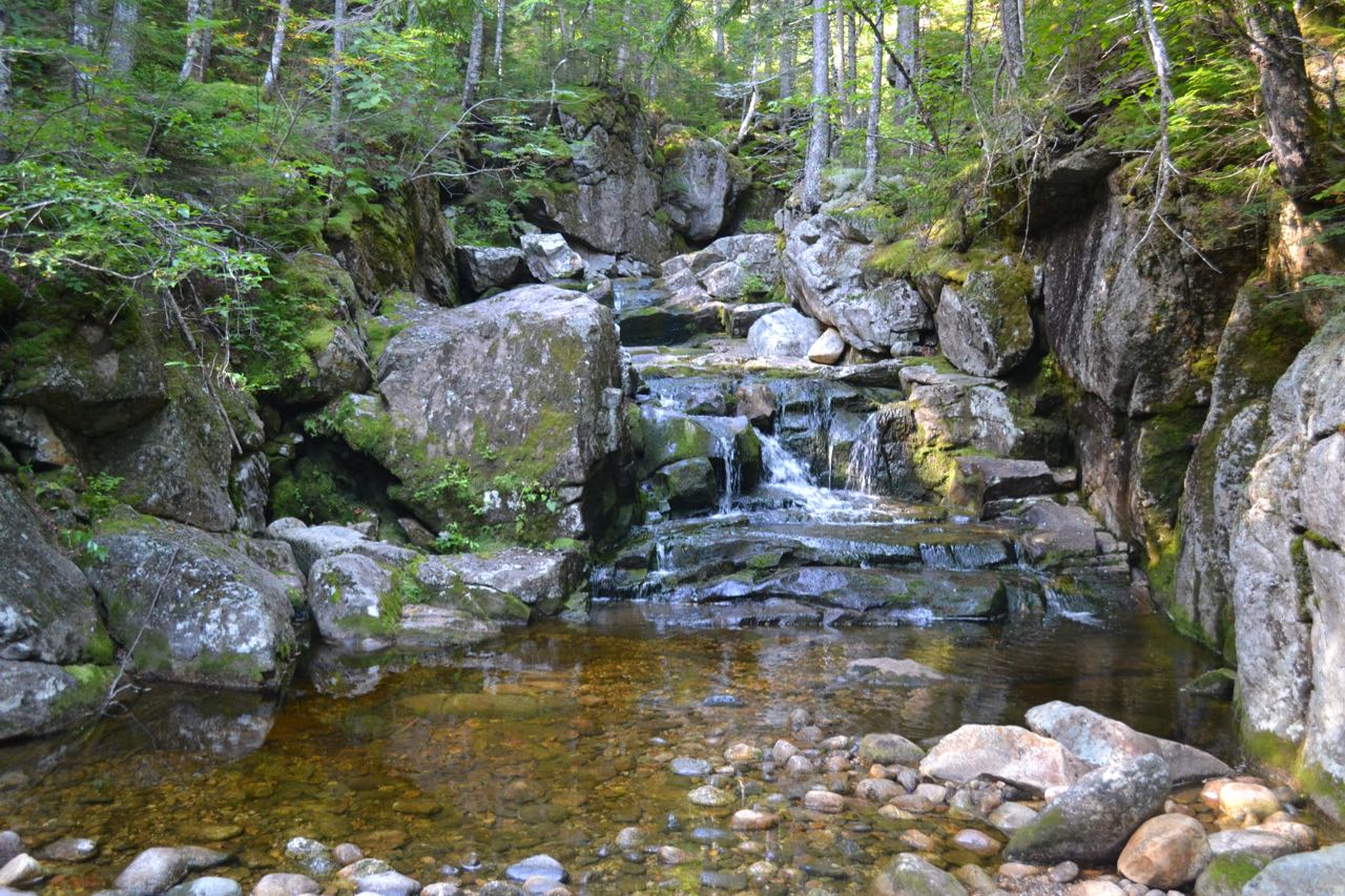
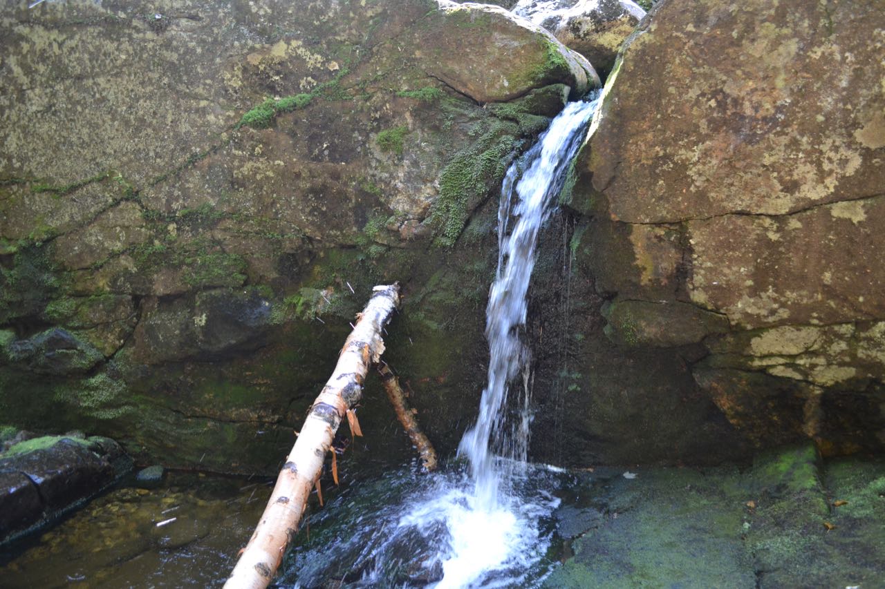
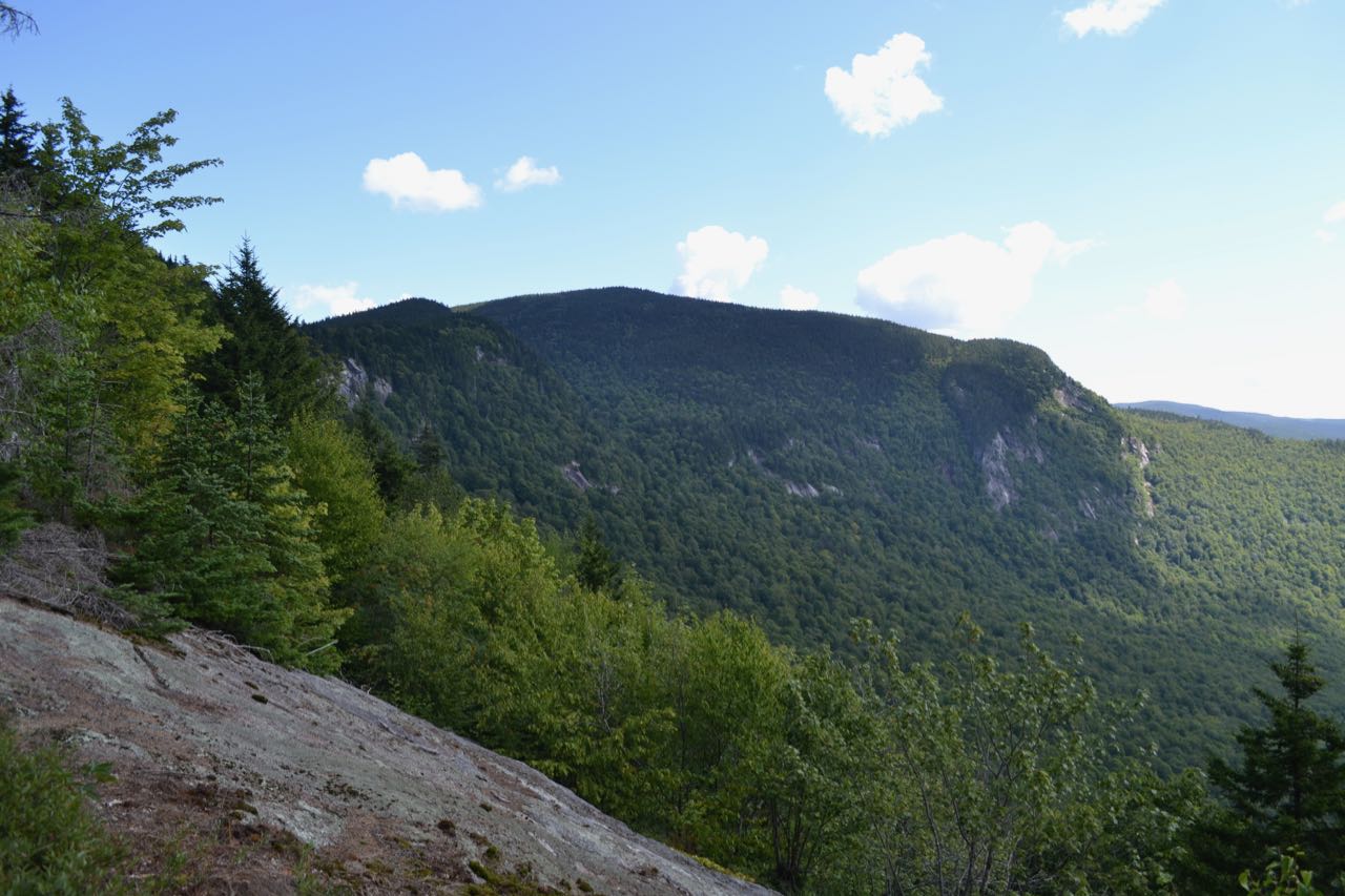
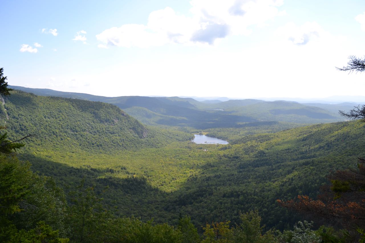
The Basin Rim is the name given to a section of the Meader Ridge at the top of the giant, hoseshoe-shaped cirque formation known as The Basin. Unlike the waterfall of the same name in Franconia Notch, this Basin is hidden away in a rather remote area of New Hampshire, in the Evans Notch region close to the Maine border. This hike will take you up the gentle slopes behind the Basin to a point on the Basin Rim where you can look out over the steep-walled valley and see its centerpiece, Basin Pond, from above. Along the way, you will follow a scenic brook through a delightful gorge with cascades and views of cliffs.
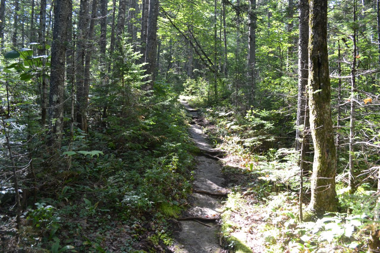
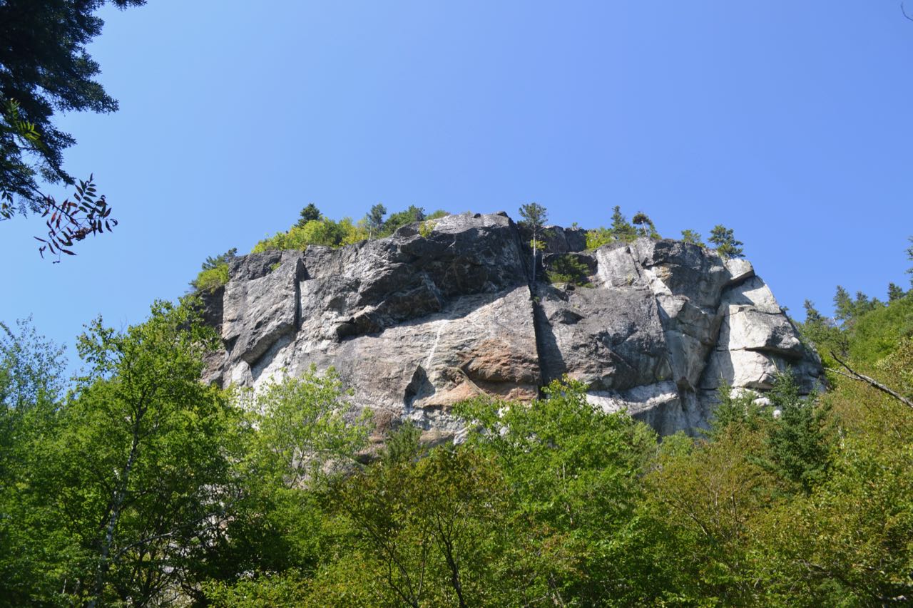
The approach to the ridge begins from the north; after driving in nearly six miles on Wild River Road, you are deep in the Wild River Valley. Start your hike on the Basin Trail, which leaves the east (left, from the direction you drove in) side of the parking area. The trail wanders through the valley forest for 0.4 miles, using a section of an old woods road. It then bears left and crosses a marshy area over bog bridges. After another 0.2 miles over flat terrain, the trail comes within sight of Blue Brook, which you will be following almost all the way to the top of the ridge. In the next tenth of a mile, the trail crosses a smaller brook across the hillside, then passes an opening at the brookside, before pulling back away to parallel Blue Brook at a distance. The trail leads across the hillside above the brook for the next 0.7 miles, never straying too far away, until it makes a short descent to cross the brook at the base of an interesting gorge filled with rapids and short cascades. On the other bank, the trail closely follows the brook through a scenic, ledgy area, where there are more oppotunities to venture out to the edge of the gorge to view the rushing brook. After 0.3 miles on the east side of the brook, the trail passes directly beneath a set of impressive cliffs on the slopes of Basin Mountain, right across the brook. There are a few good openings where you can see them in full view. The trail continues for 0.2 miles in proximity to the brook, then bears left and turns away. It climbs for about 1/4 mile up gentle slopes through open hardwood forest to a junction with Blue Brook Connector. Continue straight, staying on Basin Trail, as it climbs for another 0.2 miles to a major five-way trail junction known as Rim Junction. The Basin Trail continues straight across the junction, while Basin Rim Trail crosses it at a right angle. Black Angel Trail comes into the junction at a sharp angle from the right. From where you stand as you approach the junction on Basin, the diverging trails are, in clockwise order from your immediate left: Basin Rim Trail northbound, Basin Trail continuing east, Basin Rim Trail southbound, and Black Angel Trail. To reach the best viewpoint, you will need to take the second right onto Basin Rim Trail southbound. You are now on the crest of the Meader Ridge between Mt. Meader and West Royce Mountain, in the center of the Basin Rim. Head just a tenth of a mile down the wild, ledgy ridgetop path and you will be rewarded with an excellent viewpoint over this unusual and impressive mountain formation. You observe the floor of the horseshoe from one end looking out. Cliffs color the slopes of the cirque on both sides of you. Basin Pond rests at the bottom of the great valley in the center of your view. Beyond the end of the valley lie the low-lying Deer Hills across the border in Maine. For a continuation of this hike along the crest of the Meader Ridge to magnificent Eagle Crag, see The Meader Ridge.
Printable directions page